The Lower Guinea Fowl Trail - Port Elizabeth
- Port Elizabeth
The Lower Guinea Fowl Trail

This trail starts at the Third Avenue dip in Newton Park and follows the Baakens River down to Settlers Park and Brickmakers Kloof. It can also be done starting at the bottom and walking up or shortened by starting at Settlers Park, depending on your choice.
The trail crosses the river many times by means of stepping stones. These crossings can become hazardous or even impassable after heavy rain when flooding occurs and this hike should obviously not be attempted at such times. The trail is suitable for moderately fit persons who are advised to walk in a group, wear stout shoes and take a sun hat and drinking water. No dogs are allowed in the Settlers Park section of the trail.
The trail runs along a steep-sided valley through the city suburbs for its full length. The Baakens River, which is 23 km in length, has its source in the Hunters Retreat area and ends where it debouches into the harbour. Where the track climbs above the flood level the vegetation consists of East Cape Fynbos, which reaches its eastern limits in Port Elizabeth,as well as a good scattering of conspicuous succulents on dry northern aspect slopes. Patches of Valley Bushveld consisting of small trees and bushes occur in the kloofs which enter the valley, predominantly from the north. These kloofs act as seasonal tributaries to the river.
Some sections of the valley are infested with alien vegetation, the removal of which is an ongoing but slow and costly process. Biological controls have been introduced onto certain invasive plants such as rust fungus on Port Jackson Willow, gall wasps on the Long Leaved Acacia and a weevil on the Sesbania.
A high, sheer, knife edge spur protruding into the valley from Linkside provides a reference point to hikers when crossing the boardwalk which descends to the boundary of Dodd's Farm. (The trail can also be accessed through Dodd's Farm via Ninth Avenue Walmer). Bat's Cave is found at the Dodds Farm river crossing before the trail crosses open veld through the old Trollip's Farm to Targetkloof.
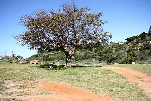
Wellington Park, on the side of the valley opposite the Settlers Park main car park, offers a panoramic view of the Baakens valley. Along the trail through Settlers Park the sheer cliffs are home to the rare Peregrine Falcon. In Settlers Park guinea fowl, mountain (leopard) tortoise, dassies and mongoose may usually be seen and, if you are lucky, grysbok and Knysna Loeries may also be spotted.
Please note that use of the area is at your own risk.
Map and Directions to The Lower Guinea Fowl Trail
GPS (Third Avenue dip) : 33° 57' 29.01" S / 25° 33' 38.44" E
GPS (Settlers Park parking areas ) : 33° 58' 13.59" S / 25° 36' 11.47" E
GPS (Brickmakers Kloof) : 33° 58' 9.51" S / 25° 37' 1.86" E
Take Cape Road to Newton Park and tunr south of 3rd Avenue. At the very bottom of the dip is a grassy area on the left where you may park or be dropped off.
To get to Settlers Park go to the south-west corner of Park Drive, which circles St George's Park, and turn into How Avenue, next to St George's Hospital. At the bottom are the gates into the park's parking area.
To get to Braickmakers Kloof, go the the east end of Park Drive, which circles St George's Park and, close to the cricket stadium, turn into Valley Road. On the right at the bottom of the hill is Cudmore Road. The trail ends here.